
Jointly Rendering Point Clouds & CAD with NUBIGON
Jointly rendering point clouds and CAD models is essential for effectively showcasing project deliverables. Whether modeling 2D CAD plans, 3D CAD models, road and rail features, or topographic models, NUBIGON offers a powerful solution to combine them with point clouds. Clip and object animations further enhance communication, helping present project results clearly to clients and stakeholders.
Combining Point Clouds & 2D CAD Models
MaxVision’s residential building survey integrates 2D floor and facade plans within the point cloud, with X-ray rendering enhancing the plans' visibility. This showcases the as-built modeling process, blending precision CAD work with point cloud data.
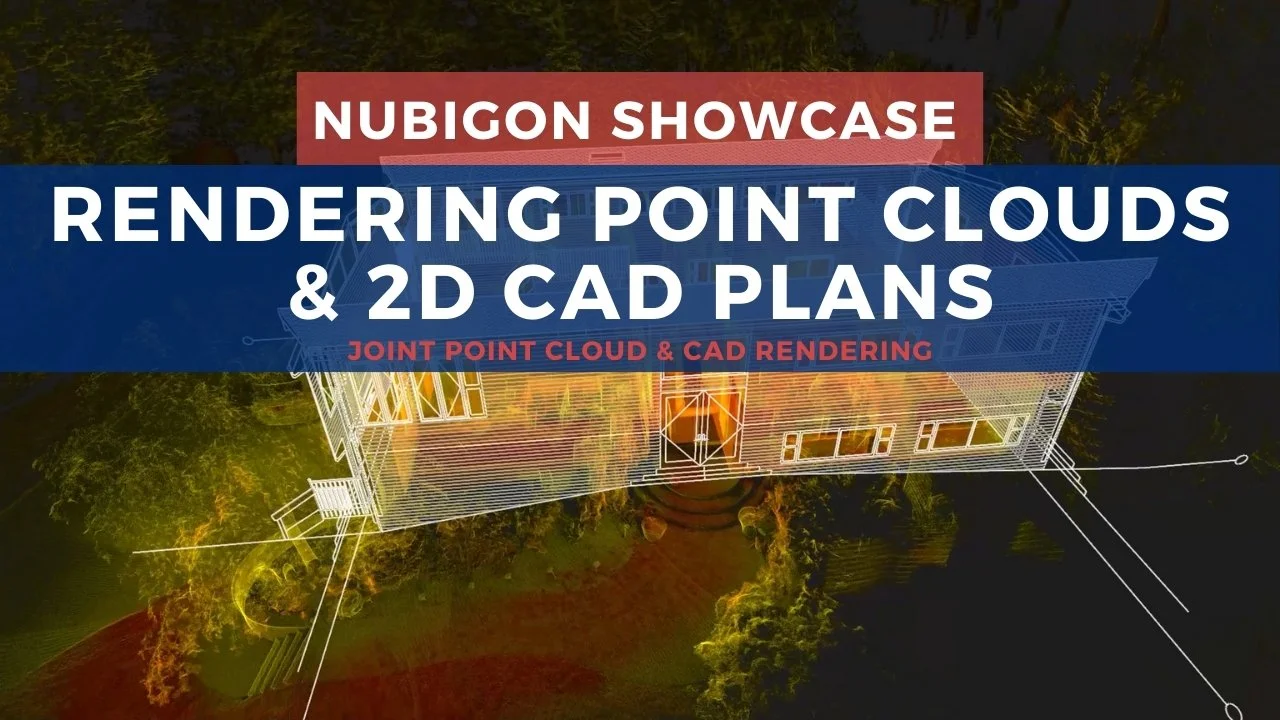
Residential Building Survey - MaxVision
Combining Point Clouds & 3D CAD Models
In this construction progress tracking project in Estonia, 3Di uses drone photogrammetry to repeatedly capture the site and embed design models into the scene to inform the project progress. NUBIGON renders both the captured conditions and models, highlighting key milestones over time.
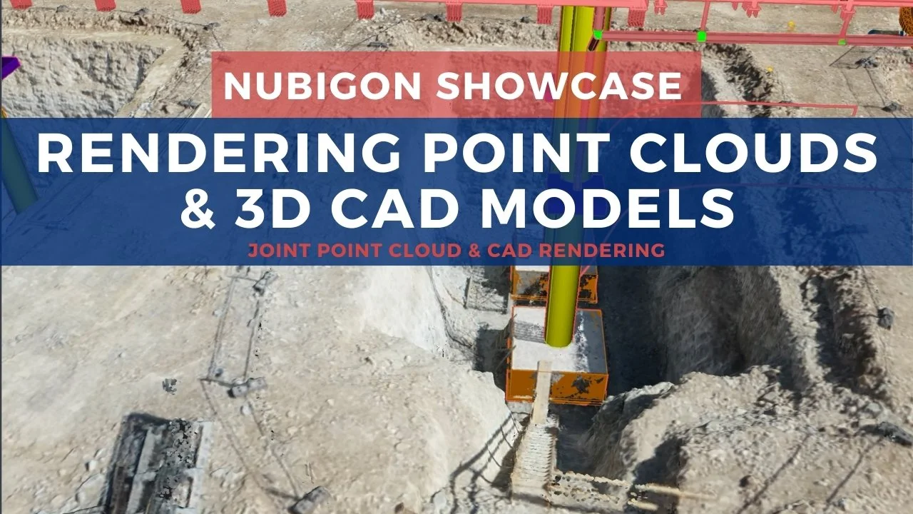
Construction Progress Tracking, Estonia - 3Di
Combining Point Clouds & Road/Rail Features
Colliers Engineering & Design’s road feature extraction project highlights NUBIGON’s ability to render point clouds alongside linework and surface models. NUBIGON showcases road and rail features with multiple render modes, enhancing project and site understanding.
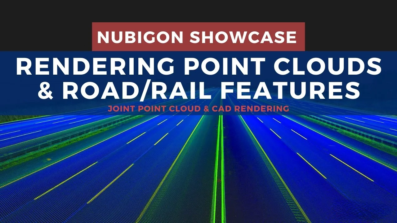
Road Feature Extraction Project - Colliers Engineering & Design
Combining Point Clouds & Topography
UAV365’s forest survey in the UK combines aerial LiDAR, handheld LiDAR, and topographic data for a detailed terrain representation. NUBIGON’s X-ray and elevation rendering modes highlight elevation changes and surface features, offering valuable insights into the landscape.

Forest Survey, UK - UAV365
Clipping Point Clouds & CAD Models
Geotwin’s LiDAR survey for a road upgrade highlights NUBIGON’s clipping animation feature, gradually revealing road features as CAD elements overlay the point cloud. This approach helps stakeholders visualize existing conditions with linework, enhancing project communication and understanding.

Aerial LiDAR Survey for a Road Upgrade, Australia - Geotwin
Animating Point Clouds & CAD Models
TPLM-3D’s industrial as-built modeling project uses NUBIGON to animate CAD components within point clouds. The rendering transitions from surface to x-ray, offering a clearer view of the CAD model, while the animation of individual components enhances understanding of the structure. This presentation highlights the model’s precision and provides clear, detailed visuals for easy project assessment.

Industrial As-built Modeling, France - TPLM-3D
Mixed-Style
Advanced 3D Laser Solutions’ scan-to-BIM project for storage tanks uses mixed rendering styles, transitioning the point cloud from surface to x-ray. Integrated 2D CAD plans and 3D BIM models within the point cloud effectively showcase the project’s results, providing a clear and comprehensive view.
