Emesent LiDAR Scanning Projects Presented with NUBIGON
The Emesent Hovermap is a versatile LiDAR mapping solution that seamlessly switches between handheld, drone, vehicle, and backpack configurations, producing high-quality point clouds. NUBIGON enhances the utility of Hovermap point clouds by providing advanced visualization and animation solutions, bringing your data to life. Discover how NUBIGON transforms Emesent scanning projects with compelling results!
Elevating Urban & Road Survey Projects
In a recent urban survey project, the Emesent Hovermap was used to scan a bustling cityscape, capturing detailed point clouds of buildings, streets, and infrastructure. NUBIGON transformed this data into an interactive 3D space, allowing city planners to visualize and analyze the urban environment. These insights regularly inform new development plans and help engage stakeholders in public consultations.
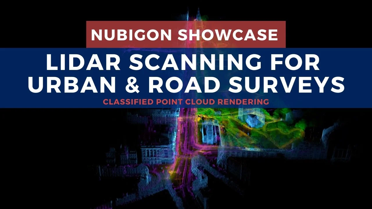
Prince Street, Edinburgh, UK - UAV 365
Streamlining Water Infrastructure Mapping
The Emesent Hovermap excels at scanning water and wastewater systems, delivering detailed point clouds while minimizing the need for personnel to enter confined spaces. Here, Hovermap was used to map a drainage culvert. The surveying team rendered the scans and as-built models in NUBIGON to assist engineers with design and planning.

Drainage Culvert, Australia - GeoTwin
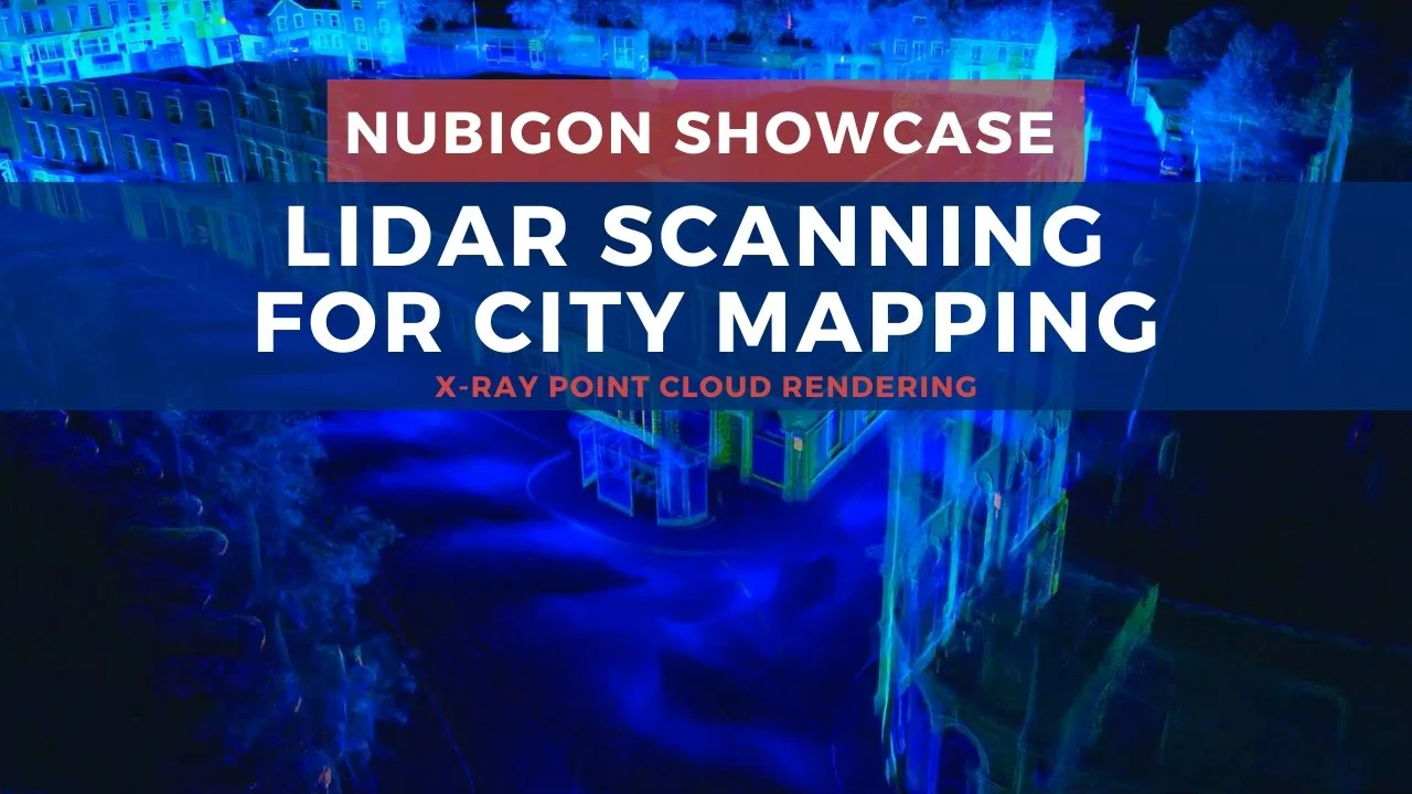
Enhanced Rendering for Mobile Mapping
With multiple configuration options, the Emesent Hovermap is ideal for city mapping. NUBIGON visualizes captured point clouds, uniquely displaying elevation, intensity, and classification for clear insights. Use NUBIGON to create impressive point cloud flythroughs and present your mobile mapping projects effectively.